The Portland Public Market building is seen here in 1942 along Front Street looking northeast from Salmon; we’d see Salmon Street Springs on the right edge of the photo today. It must have been a nice summer day when this photo was taken; most windows are open to catch the breeze in the days before air-conditioning was common.
Monthly Archives: May 2013
SE Powell & 39th, 1937
NE 41st & Sandy, 1934
Carlton Hotel, 1917
NE Portland Aerial, 1947
This 1947 aerial photo covers a lot of area of Northeast Portland. From Burnside at the bottom, the view stretches out past Alameda Ridge in the distance. There’s some pretty good detail in the foreground, including Buckman Field Park, Benson Polytechnic High, Sullivan’s Gulch and the site of the future Lloyd Center.
SW Montgomery Dr & Vista, 1932
Hard to believe that somebody would build on the the lot on this corner due to the steepness of the slope. It would take almost a half-century but a single family home sits on the SW Montgomery Drive site just below where it meets SW Vista (beyond railing at top). It looks like Montgomery was getting the forms removed from its first paving job.
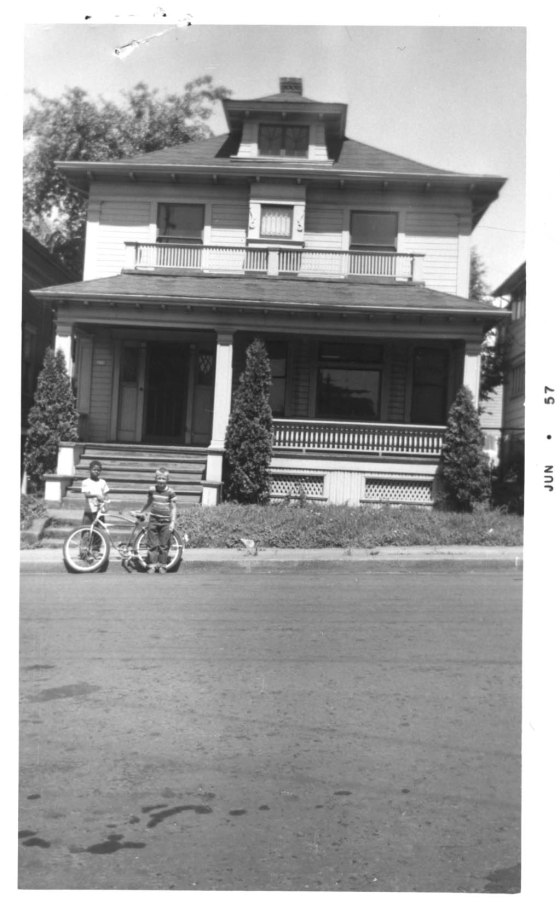
219 N Cherry, 1957
There’s nothing particularly historic about this photo but it’s a classic mid-century American scene. If these two kids were standing here today, they’d be in their 60s and standing in the Rose Garden/Memorial Coliseum parking lot. Neither Cherry Street, nor Ross Avenue, just a house away to the right, exist today. This home had some nice stained glass and woodworking details to give it a little extra style.


