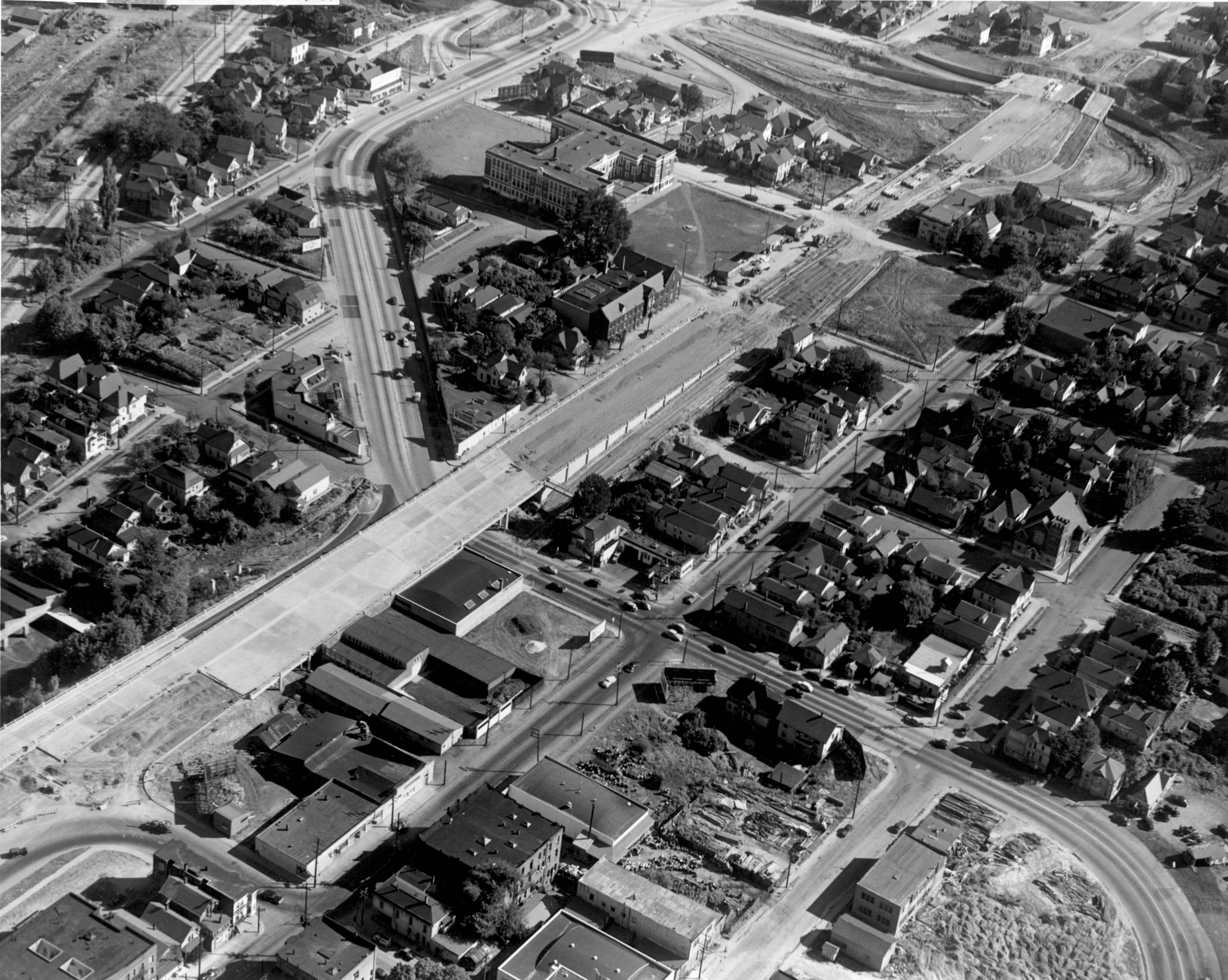
Crews in 1947 work on the SW Harbor Drive overpass over SW Arthur Street, widening Harbor Dr. and building connections to the Ross Island Bridge. This section of roadway is now SW Naito Parkway and the view is to the southeast. Maybe half of the buildings we see here are still intact.
Monthly Archives: December 2012
Unidentified Building, c1944 – Help Us Out!
Our last mystery to solve this year is this unidentified building from circa 1944. No location information is given so it could be anywhere in the Portland area (we think). This would appear to be new construction of a public facility; school, library, post office, etc. Any ideas?
Found: Housing Authority of Portland admin building, Columbia Villa
Greyhound Maintenance Garage, 2008
Fans of the old Greyhound maintenance garage at SW Water Avenue & Sheridan Street will be saddened to know that it no longer exists. Alert VP reader Ian Fraley alerted me two weeks ago that it was being torn down. By the time I could get down there, only a pile of debris remained. You can see the building in this 1964 aerial photo with a bit of discussion about it in the comments.
2008:
2012:
Aerial of Downtown, 1938
Sandy Blvd Extension, 1929
This photo is a bit of a mystery. The record for it says, “Photo is documenting extension of Sandy to SE Belmont.” I don’t know exactly which corner it was but I have a feeling it looks southwest at Burnside and 12th where Sandy will make its diagonal cut. This must have been the golden age of billboards; this one is a beauty!