
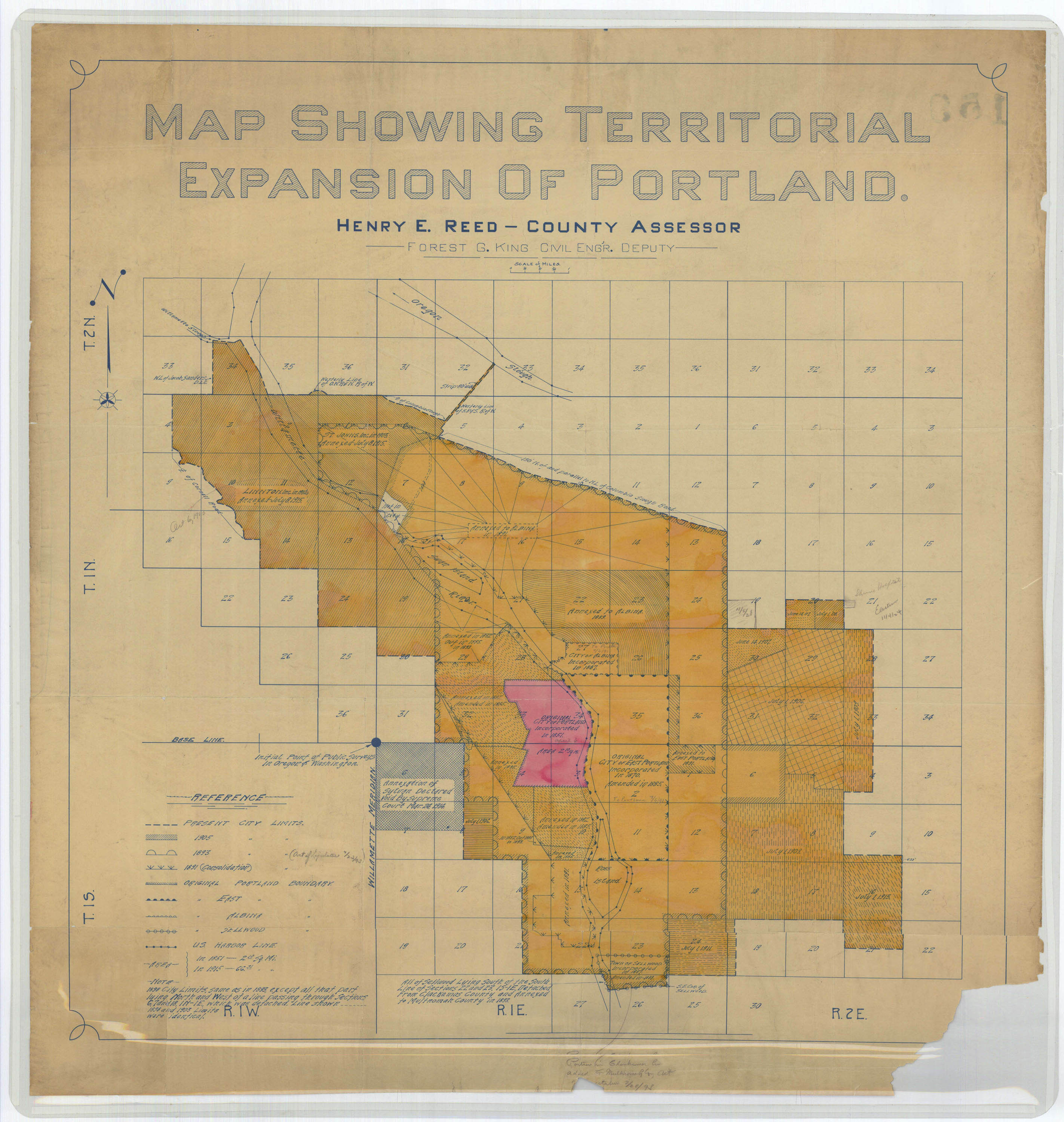
This map shows the territorial expansion of Portland through annexation over the years, from the original 1851 incorporation through 1915 when this map was produced. A quick modern-day map overlay shows the boundaries were roughly Lombard Street Columbia Blvd. in the north, 82nd Avenue in the east and Sellwood in the south at that time.
 (City of Portland Archives)

Very interesting map. It looks like the eastern boundary was mostly 92nd then. 82nd is a section boundary and the line cutting in half sections 28, 33 and part of 4 would be 92nd. So from the top of section 28 (two sections north of the baseline Stark) which would be NE Fremont to about 4/5 of a section south of Stark, it appears 92nd was the boundary.
Doesn’t it say the northern boundary is “150′ N. of and parallel to NL of Columbia Slough rd”? I assume that would be Columbia Blvd today?
Also interesting is the small “island” on the bluff NW of Swan Island that is marked “not in city”. I wonder if this is UofP land?
Here’s some info about “Sylvan” and its failed annexation:
http://bit.ly/XpGGZg
City resolution to refund taxes to residenents of Sylvan:
http://webcache.googleusercontent.com/search?q=cache:gh6k28e5tQsJ:efiles.portlandoregon.gov/webdrawer/rec/4117314/view/3b.PDF+&cd=3&hl=en&ct=clnk&gl=us
Oregonian article about Lents which mentions the OR supreme court decision:
http://oregonnews.uoregon.edu/lccn/sn83025138/1914-04-07/ed-1/seq-13/
Always wondered about that little chunk of Southern Sellwood. I had no idea you could just detach from one county and attach to an adjacent one.